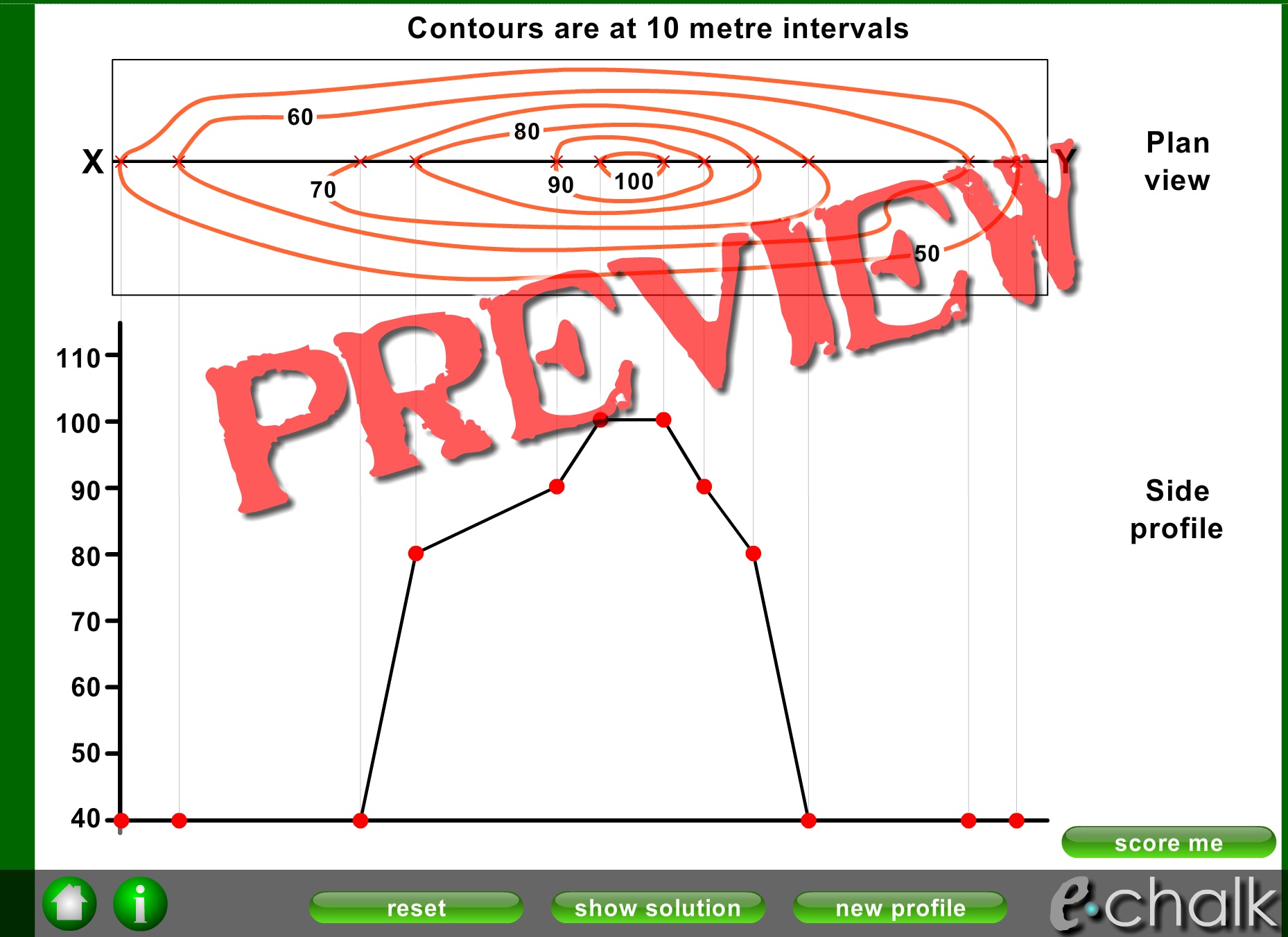
Contours

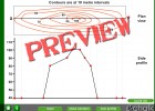
This is and interactive application to understand the correlation between contours on a map and the side profile of a geological feature. Students have to drag the dots on the X-axis to display the height in the Y-axis. We can practice map reading skills and some geographical vocabulary.
-
Idioma:
- Inglés
Recurso educativo
-
Aún no hay comentarios, ¡comparte tu opinión! Inicia sesión o Únete a Tiching para poder comentar

¿Dónde quieres compartirlo?
¿Quieres copiar el enlace?